4butSuG7t+G7s+G6vOG7juG6rsWoxahyw73DmWtLxq/hu47hu4DDveG7r+G7ieG7qOG6rsOUxKjhu7Nr4bumS+G7s8OZ4bum4buQw5Xhu5DGr+G7gMWo4buzw4pLxKhLxq/huq7hu45LeuG6rsavS+G7kMOU4buzS8OU4buz4buI4buQ4bum4buAxajGr+G7s8OZ4bum4buQxq/hu4DhurzGr0vhu5DDlOG7rS9K4bu34buv4butw5nhu7Phurzhu47huq7FqMWocsO9w5nhurfhu4Dhuq7DisO94buva0rhu4Dhu7PDleG6rsOU4bquxKjhu4DDleG7gMOUxq/hu7Phu5Dhu4jhu7Phu4jhu5Dhu6bhu4DFqMav4buzw5nhu6bhu5DGr+G7gOG6vMavS+G7kMOU4buzS8Wo4buzS8OU4bq84bum4buA4bquxahLw5TEqOG7jiPhu7Phu4jhuq7hurxLw5TEqOG7s8OU4buow5Xhu4Dhu6bhu5Dhu6jFqOG7s+G6vErhuq7hu47hu47hu4DDlMSo4buAxajFqeG7s+G7uEvGr0rhu7PDiuG7uEvDlMOK4buOS8OUxKjhu7Phu4jhu5Dhu6bhu4DFqMav4buz4bum4bquw5TEqOG7gOG7psWoJ+G7s+G7iOG7kOG7puG6vOG7gMWo4buz4bquw5TDiuG7s+G7tuG6rsWoxq/hu7Phu4jhu5Dhu6bhu4DFqMav4buz4bqu4bum4buA4bquxajFqeG7s+G7uEpL4buO4buA4buz4bu2S+G7kOG7juG6rsav4buQ4bumxajhu7NK4bqu4bu24buA4buz4bq64buA4bq84buQw5Xhu4Dhu7PDleG7kOG7puG7gOG7s8Wo4buQw5lKS8Woxq9L4bq84bquxq/hu4DDisWp4buz4bq84bqu4buoxahLw5TEqOG7s8OKS+G7iOG7iEvhurzhu6jhu47Gr0vhu4DFqOG7s+G7iOG7kOG7puG7s+G7iOG7kOG7puG7gMWoxq/hu7Phu5Dhu7jDlOG7gOG7psWo4buz4bquw5TDiuG7s+G6ruG7qMavSuG7kOG7pkvGr0vhu4DFqMaw4buza+G7kOG7s+G6rsOZw5nhu44j4buzxajhurxL4buAw5TGr0vhu4hL4bq84buz4bquw5TDiuG7s8av4buA4bq8SsOU4buQ4buO4buQxKhL4bq84bqu4buO4buz4bquw4rhu7bhuq7DlOG6vOG7gMWo4buzxq/hu5Dhu7Phu4jhu5Dhu6bhu4DFqMav4buzw5nhu6bhu5DGr+G7gOG6vMavS+G7kMOUxanhu7Phuq7hu7Phu6bhu4DFqOG7gOG6ruG7puG6vErhu7PGr+G7gOG6rsOV4buzS8OU4buzxq9K4buA4buzP8So4bumS+G6vOG7qOG7jsav4buo4bum4buA4buz4bquw5TDiuG7s+G6r+G7kOG7puG7gMWoxq/hu6Yj4buzxajhu4DhurzGr+G7kOG7puG7s+G7kOG7iOG7s8avSuG7gOG7s8OZ4bum4buQ4bu2S8OU4bq84buA4buzSuG6rsWo4buzxajGr+G7qMOKS+G7gMOK4buz4bquw5TDiuG7s0vDlcOZ4buO4buAw5Xhu4DDlMav4buAw4rhu7NLw5Thu4jhu5Dhu6bDleG6rsavS+G7kMOU4buzxq/hu4DhurxKw5Thu5Dhu47hu5DEqCPhu7PFqOG7kOG7iMav4bu44bqu4bum4buA4buzS8OU4buz4buI4buQ4bum4buAxajGr+G7piPhu7PGr+G7kOG7s+G6rsOU4bqu4buOI3rhu4Dhu7PFqOG6rsav4buA4buO4buOS8av4buA4buzS8OV4bquxKjhu4DFqOG7s+G7iOG7kOG7puG7s+G7gOG6ruG7puG7jiPhu7PDiuG7gMav4buA4bq8xq9L4buQw5Thu7Phu5Dhu4jhu7Phu4jhu5Dhu6bhu4DFqMav4buzxajGr+G6rsav4buoxajhu7PhurxK4bquw5TEqOG7gMWo4buz4buQw5Thu7PGr0rhu4Dhu7PEqOG7puG7kOG7qMOUw4rFqeG7s8Wo4buow5nDmeG7kOG7psavS8OUxKjhu7Phu4jhu5Dhu6bhu4DFqMav4buzw5nhu6bhu5DGr+G7gOG6vMavS+G7kMOU4buz4bu44buQ4bum4buM4buzS8OU4buzxq9K4buA4buzw5nhu6bhu5Dhu7ZLw5Thurzhu4DGsOG7s2tKS8Wo4buzw5nhu6bhu5DDkuG7gOG6vMav4buz4bu44buQw5Thu7PGr0rhu4Dhu7PGr0pL4bumw4rhu7PDmeG7pkt64buA4buz4bquxq/hu7PGr0rhu4Dhu7Phu4vhu6bhu5Dhu7ZLw5Thurzhu4DigJnFqOG7s+G7t+G7tcavSuG7s2vhu4DhurxKw5RL4bq84bqu4buO4buz4bqzw5TDlOG7kOG7tuG6rsavS+G7kMOU4buzM+G7kMOUxq/hu4DFqMav4buzS8OU4buz4bu54bu14bu5QeG7s+G6rsOUw4rhu7Phu6bhu4Dhurzhu4BL4bu24buAw4rhu7Phuq7hu7Mz4buQw5TFqOG7kOG7juG6rsavS+G7kMOU4buzw5nhu6ZLeuG7gOG7s+G6rsav4buzxq9K4buA4buz4bu34bqixq9K4buzZOG6rsavS+G7kMOU4bqu4buO4buza+G7gOG6vErDlEvhurzhuq7hu47hu7PhurPDlMOU4buQ4bu24bquxq9L4buQw5Thu7Mz4buQw5XDmeG7gMavS8avS+G7kMOU4buzS8OU4buz4bu54bu14bu5Qcaw4butL8OZ4buv4butw5nhu7Phurzhu47huq7FqMWocsO9w5ky4buQw4ojw73hu6/hu61Lw5XEqOG7s+G6vOG7juG6rsWoxahyw71LM+G7gMOUxq/hu4Dhu6bDveG7s8Wo4bum4bq8csO9Ssavxq/DmcWo4bulLy/hurzGsOG6uuG6ruG7kOG7pOG7qOG6rsOUxKjGr+G7pkvGsOG7tsOUL8OK4buAxajhu4zGr+G7kMOZL8OU4buA4bu4xagv4bu5w4Hhu7fDgy/hu7fhu7fDgcOKQeG7ueG7t8OAQcOA4bu3xq/hu7fDgeG7ucOB4buO4bqiLeG6rsOUSuG7jOG7jsaw4bu44buA4bq6w5nDveG7s+G6ruG7jsavcsO94buJ4buo4bquw5TEqOG7s2vhu6ZL4buzw5nhu6bhu5DDleG7kMav4buAxajhu7PDikvEqEvGr+G6ruG7jkt64bquxq9L4buQw5Thu7NLw5Thu7Phu4jhu5Dhu6bhu4DFqMav4buzw5nhu6bhu5DGr+G7gOG6vMavS+G7kMOUw73hu7Mv4buv4butL8OZ4buv4butw5nhu7Phurzhu47huq7FqMWocsO9w5kz4bquw5nGr0vhu5DDlMO94buvP+G7s+G7iEvhu6bhu4Dhu7NLw5Thu7Phurfhu6jDlMSo4buz4bq34buQ4bqu4oCZxajhu7Phu4jhu5Dhu6bhu4DFqMavLeG7s+G7i0rhu5DGr+G7kOG7peG7s+G6q2Lhu4lr4butL8OZ4buv4butw5nhu7Phurzhu47huq7FqMWocsO9w5ky4buQw4ojw73hu69sw5TGr0vhu47hu7PDlOG7kOG7uMWp4buzw5Xhu5DFqMav4buz4bu2S+G7kOG7juG6rsavS+G7kMOUxajhu7Phu6bhu4Dhu47huq7Gr+G7gMOK4buzxq/hu5Dhu7Phu4jhu5Dhu6bhu4DFqMav4buz4buAQMOZ4buO4buQS8av4bquxq9L4buQw5Thu7Phuq7DlMOK4buz4buAw5Thurzhu6bhu5Dhuq7hurxKw5Xhu4DDlMav4buzSuG6ruG7tuG7gOG7s+G6uuG7gOG7gMOU4buzw4rhu4DGr+G7gOG6vMav4buAw4rhu7PGr0rhu6bhu5Dhu6jEqErhu7PDleG6rsOU4buo4bqu4buO4buz4bum4buAw5nhu5Dhu6bGr0vDlMSo4buz4bquw5TDiuG7s+G7juG7kMOUxKjhu7PDmeG6rsav4bum4buQ4buOxajGsOG7s+G6t+G7kOG7uOG7gOG7tuG7gOG7psWp4buzxq9KS8Wo4buzxq/hu6bhuq7DikvGr0vhu5DDlOG6ruG7juG7s8OV4buAxq9K4buQw4rhu7NK4bquxajhu7PFqOG7gOG7tuG7gOG7puG6ruG7juG7s+G7jkvDlUvGr+G6rsavS+G7kMOUxajhu6Xhu7NLxq/hu7Phurzhu5DDlMWo4buow5Xhu4DFqOG7s8avS8OV4buA4buz4bquw5TDiuG7s8OV4bquw5TDmeG7kOG7uOG7gOG7psWp4buz4bum4buAw5nhu5Dhu6bGr8Wo4buz4bqu4bum4buA4buz4buQ4buIxq/hu4DDlOG7s8OK4buA4buO4bquI+G7gMOKxanhu7Phuroj4buzxq9K4buA4buzxq9Lw5Xhu4Dhu7Phu7ZL4buQ4buO4bquxq9L4buQw5TFqOG7s+G6ruG7puG7gOG7s8OK4buAxq/hu4DhurzGr+G7gMOKxanhu7Phurzhu5DDlMWoS8OK4buA4bum4bqu4bq64buO4buA4buzw4rhuq7DleG6rsSo4buA4buzSuG6rsWo4buz4buoxajhu6jhuq7hu47hu44j4buz4buQ4bq84bq84buo4bum4bum4buAw4rFqeG7s8OV4bqu4buMS8OUxKjhu7NLw5Thu7bhu4DFqMavS8So4bquxq9L4buQw5TFqOG7s+G6rsOUw4rhu7Phu7bhu4Dhu6ZL4buIS+G6vOG6rsavS+G7kMOUxajhu7PDikvhu4jhu4hL4bq84buo4buOxq/GsOG7szPhu5DDlMWo4buA4buk4buo4buAw5TGr+G7jiPFqeG7s+G6vOG7kMOV4bq64bquxq9Lw5TEqOG7s8avSuG7gMWo4buA4buz4bu2S+G7kOG7juG6rsavS+G7kMOUxajhu7Phurrhu4Dhurzhu5DDleG7gMWo4buz4buAQMav4bum4buAw5Xhu4Dhu44j4buz4bq8SuG6ruG7juG7juG7gMOUxKhLw5TEqMWp4buz4bquw5TDiuG7s+G7puG7gMWo4buQ4buo4bum4bq84buAxajhu7Phuq7hu6bhu4Dhu7Phu45Lw5VLxq/hu4DDisaw4butL8OZ4buv4butw5nhu7Phurzhu47huq7FqMWocsO9w5ky4buQw4ojw73hu6/hurFL4bu24buAw5Thu7PGr0pLxajhu7PFqEvGr+G7qOG6rsavS+G7kMOUxanhu7Phuq7hu7Phu6bhu4DFqOG7gOG6ruG7puG6vErhu7PGr+G7gOG6rsOV4buzxajhu5Dhu6jEqErGr+G7s8av4buQ4buz4buQ4bu24buA4bum4bq84buQw5Xhu4Dhu7PGr0rhu4DFqOG7gOG7s+G7jkvDlUvGr+G6rsavS+G7kMOUxajhu7Phuroj4buzw5nhu6bhu5Dhuq7hurzGr0vhu7bhu4Dhu44j4buzw4rhu4DGr+G7gOG6vMavS8OUxKjhu7Phu4jhu5Dhu6bhu4DFqMav4buzxajGr+G6rsav4buoxajhu7PhurxK4bquw5TEqOG7gMWo4buz4buoxahLw5TEqOG7s+G6rsOK4bu24bquw5Thurzhu4DDiuG7s8av4buA4bq8SsOU4buQ4buO4buQxKgjxrDhu7NrSuG7gEvhu6bhu7Phuq7DmcOZ4bum4buQ4bqu4bq8SuG7s+G6rkvDleG7gMOK4buzxq/hu5Dhu7Phu5Dhu6bEqOG6rsOUS3rhu4Dhu7PDmeG6rsav4bum4buQ4buOxajhu7Phuq7DlMOK4buzS8OUxajDmeG7gOG6vMavS+G7kMOUxajhu7PDleG7kOG7puG7gOG7s+G7gOG7iOG7iEvhurxL4buAw5TGr+G7jiPFqeG7s+G7puG7gMOK4buo4bq8S8OUxKjhu7PDmeG7puG7gMWoxajhu6jhu6bhu4Dhu7Phu5DDlOG7s+G7iOG7kOG7puG7gMWoxq/hu7Phu6bhuq7DlMSo4buA4bum4buz4buI4buQ4bum4bq84buAxajhu7Phuq7DlMOK4buz4buI4buQ4bum4buAxajGr+G7s+G7kOG7uMOU4buA4bumxajFqeG7s+G7uEpL4buO4buA4buz4bqu4buOxajhu5Dhu7Phu4DDlOG6ruG6uuG7jkvDlMSo4buzxq9Lw5Xhu4Dhu44j4buzS8OU4buI4buQ4bumw5Xhuq7Gr0vhu5DDlOG7s8So4bquxq9K4buA4bumS8OUxKjhu7Phu4jhu5Dhu6bhu7PDmeG7puG7gOG7tuG7gMOUxq9L4buQw5Thu7Phu4Dhu4jhu4jhu5Dhu6bGr8WoxrDhu60vw5nhu6/hu63DmeG7s+G6vOG7juG6rsWoxahyw73DmTLhu5DDiiPDveG7r2tK4buA4buzxq/hu4DhurxKw5RL4bq84bqu4buO4buzxajhu5Dhu47hu6jGr0vhu5DDlOG7s0vDlOG7tuG7kOG7juG7tuG7gMOK4buz4buoxq9L4buOS3pLw5TEqOG7s+G7puG7gMSoS8Woxq/hu4Dhu6bhu4DDiuG7s+G6ruG6vOG6vOG7kOG7qMOUxq/FqOG7s8av4buQ4buz4bqu4bq84bq84buAxajFqOG7s8Wo4bquxq/hu4Dhu47hu45Lxq/hu4Dhu7NLw5Xhuq7EqOG7gMWo4buz4buI4bum4buQw5Xhu7Phu4vhu47huq7DlOG7gMavxanhu7Phu4DDlcOZ4buO4buQI0vDlMSo4buz4buJ4bqx4bqzauG7s8Wo4buQ4buIxq/hu7jhuq7hu6bhu4Dhu7PGr+G7kOG7s8OK4buQ4bu4w5Thu47hu5Dhuq7DiuG7s8Wo4bquxq/hu4Dhu47hu45Lxq/hu4Dhu7NLw5Xhuq7EqOG7gMWo4buz4buQ4buI4buz4buJ4buo4bquw5TEqOG7s2vhu6ZL4buzw5nhu6bhu5Dhu7ZLw5Thurzhu4Dhu7Phurrhu4Dhu4jhu5Dhu6bhu4Dhu7Phuq7DlMOK4buz4bqu4buIxq/hu4Dhu6bhu7PGr0rhu4Dhu7PDleG7kMOUS8av4buQ4bum4buAw4rhu7PDmeG7gOG7pkvhu5DDisWp4buz4bquw5TDiuG7s+G7kOG7tuG7gOG7puG7juG6riNLw5TEqOG7s8avSuG7gMOV4buz4bu4S8avSuG7s8avSuG7gOG7s+G7juG6rsav4buAxajGr+G7s+G7iOG7kOG7puG7gMWoxq/hu7PFqMav4bquxq/hu6jFqOG7s8OV4bquw5nFqMaw4buza0rhu4Dhu7Nj4bquw5nFqOG7uEvDmeG7gMav4buQ4buQ4buO4buzxq/hu5Dhu5Dhu47hu7Phu7hLxq9KS8OU4buz4buJ4bqx4bqzauG7s+G7uOG6rsWo4buz4buoxajhu4DDiuG7s8av4buQ4buz4bq84buQw5XDmeG6ruG7puG7gOG7s+G6ruG7puG7gOG6rsWo4buz4buQ4buI4buz4bq8SuG6rsOUxKjhu4DFqeG7s+G6rsOUw4rhu7PDleG6ruG7puG7jOG7s+G6rsOUw4rhu7Phu4BAw5nhu5Dhu6bGr+G7s8avSuG7gMWo4buA4buz4bq8SuG6rsOUxKjhu4DFqOG7s0vDlOG7s+G7iOG7kOG7psOV4bquxq/FqOG7s+G7jkvhu4zhu4Dhu7N1xrDhu4zDleG7jsWp4buzdcaw4buMw5V64buz4buI4buQ4bum4buz4buI4buo4bumxq9K4buA4bum4buz4bu24buA4bumS+G7iEvhurzhuq7Gr0vhu5DDlOG7s+G7kMOU4buz4buQ4buOw4rhu4Dhu6bhu7PFqOG6rsav4buA4buO4buOS8av4buA4buzS8OV4bquxKjhu4DFqOG7s+G7tkvhuq7hu7PhurHhu5Dhu5DEqOG7juG7gOG7szbhuq7hu6bGr0rGsOG7s2rhu6jhurrFqOG7gOG7pOG7qOG7gMOUxq/hu44jxanhu7PFqMOV4bqu4bumxq/DmUrhu5DDlOG7gMWo4buz4bu4S8avSuG7s8Wo4bquxq/hu4Dhu47hu45Lxq/hu4Dhu7NLw5Xhuq7EqOG7gOG7s+G6rsOZw5nFqOG7s8Wo4buo4bq8SuG7s+G6rsWo4buzY+G6rsOZS8OU4bumxanhu7PhurHhu4Dhu5DDmeG7iOG7gMWoxanhu7Phuq7DlMOK4buz4buZxq/hu5Dhu5Dhu47hu7Phu7jhu4Dhu6bhu4Dhu7Phu6jFqOG7gMOK4buz4buI4buQ4bum4buz4buQw5QtxahLxq/hu4Dhu7NLw5TFqMOZ4buA4bq8xq9L4buQw5TFqMaw4butL8OZ4buv4butw5nhu7Phurzhu47huq7FqMWocsO9w5ky4buQw4ojw73hu68/w5Thu5DGr0rhu4Dhu6bhu7Phuq7FqMOZ4buA4bq8xq/hu7Phu5Dhu4jhu7PGr0rhu4Dhu7PFqOG7kOG7juG7qMavS+G7kMOU4buz4bu44bquxajhu7Phu6jFqEvDlMSo4buz4bq84buQw5XDmeG7qMav4buA4bumxajhu7Phu7hLxq9K4buz4buJ4bqx4bqzauG7s8Wo4buQ4buIxq/hu7jhuq7hu6bhu4Dhu7PGr+G7kOG7s+G7iOG7kOG7psOV4bquxq/hu7Phu5lk4bu54bu14bu14bu14buz4bq84buQ4buQ4bumw4pLw5Thuq7Gr+G7gOG7s8WoI8Woxq/hu4DDlcWo4buz4buI4buQ4bum4buz4buL4buO4bquw5Thu4DGr+G7s8Wo4bquxq/hu4Dhu47hu45Lxq/hu4Dhu7NLw5Xhuq7EqOG7gMWoxrDhu7NrSuG7gMWo4buA4buzS8OV4bquxKjhu4DFqOG7s+G7uOG7gOG7puG7gOG7s8avSuG7gMOU4buz4buQ4bu24buA4bum4buO4bquS8OK4buz4bu4S8avSuG7s+G7kOG7jsOK4buA4bum4buzS8OV4bquxKjhu4DFqOG7s+G6rsOUw4rhu7PGr0rhu4Dhu7Phu47huq7Gr+G7gMWoxq/hu7Phu4jhu5Dhu6bhu4DFqMav4buzxajGr+G6rsav4buoxajhu7PDleG6rsOZxajhu7Phu6jFqEvDlMSo4buzY+G6rsOZS8OU4buI4buQ4bum4buzxajhu5Dhu4jGr+G7uOG6ruG7puG7gOG7s+G7iOG7kOG7puG7s8Wo4bq84bquw5TDlEvDlMSo4buz4bquw5TDiuG7s0vDiuG7gMOUxq9L4buII0vDlMSo4buz4buI4buQ4bum4buAxajGr+G7s8Woxq/huq7Gr+G7qMWo4buz4bq8SuG6rsOUxKjhu4DFqOG7s+G7kOG7puG7s+G6vErhuq7DlMSo4buAxajhu7NLw5Thu7Phu47huq7DlMOK4buz4bquw5TDiuG7s+G7puG7gMWo4buQ4buo4bum4bq84buAxajhu7Phu5DDlOG7s8avSuG7gOG7s8So4bum4buQ4buow5TDisaw4butL8OZ4buv4butw5nhu7Phurzhu47huq7FqMWocsO9w5ky4buQw4ojw73hu69rSuG7gOG7s8Wo4buQ4buO4buoxq9L4buQw5Thu7Phu7jhuq7FqOG7s0vDlcOZ4buO4buAw5Xhu4DDlMav4buAw4rhu7Phuq7hurzhu6bhu5DFqMWo4buzxq9K4buA4buz4buAw5TGr0vhu6bhu4Dhu7Phu4jhu5Dhu6bhu4DFqMav4buz4bquw5TDiuG7s+G7iOG7kOG7puG7gMWoxq/hu6Yj4buz4buO4bquw5TDiuG7s+G6ruG7puG7gOG6ruG7s+G7kOG7iOG7s8avSuG7gOG7s8OZ4bum4buQ4bu2S8OU4bq84buAxanhu7PGr+G7kMav4bqu4buOS8OUxKjhu7Phu7nDgcODxanhu7fhu7nhu7fGsOG6oOG7s0rhu4DhurzGr+G6ruG7puG7gMWoxanhu7NLw5Thurzhu47hu6jDikvDlMSo4buz4bu34bu54bqgxanhuqDEguG7ucaww4Hhu7NK4buA4bq8xq/huq7hu6bhu4DFqOG7s+G7kOG7iOG7s8OU4bquxq/hu6jhu6bhuq7hu47hu7Phu4jhu5Dhu6bhu4DFqMavxanhu7Phu7fhu7nhu7fFqcOB4bu54bu1xrDhu7nhu7NK4buA4bq8xq/huq7hu6bhu4DFqOG7s+G7kOG7iOG7s8OZ4buO4bquw5TGr+G7gMOK4buz4buI4buQ4bum4buAxajGr8Wp4buz4bquw5TDiuG7s0HhuqLFqeG6osOA4bqgxrDhu7Xhu7NK4buA4bq8xq/huq7hu6bhu4DFqOG7s+G7kOG7iOG7s8OZ4buO4bquw5TDlOG7gMOK4buz4buI4buQ4bum4buAxajGr+G7piPhu7Phu47huq7DlMOK4buzw4rhu4Dhu7bhu4Dhu47hu5DDmcOV4buAw5TGr+G7s+G6ruG7puG7gOG6rsWoxrDhu60vw5nhu6/hu63DmeG7s+G6vOG7juG6rsWoxahyw73DmTLhu5DDiiPDveG7r2tK4buA4buzw4pLxKhLxq9LeuG6rsavS+G7kMOU4buz4buQ4buI4buz4buI4buQ4bum4buAxajGr+G7piPFqeG7s8avSuG7puG7kOG7qMSoSuG7s8avSuG7gOG7s+G6rsOZw5nhu45L4bq84bquxq9L4buQw5Thu7Phu5Dhu4jhu7PhurMza+G7s8Wo4buQ4buIxq/hu7jhuq7hu6bhu4DFqeG7s8OZ4bqu4bumxq9L4bq84buo4buO4bqu4bum4buOI+G7s+G7ieG6seG6s2rFqeG7s2Phuq7DmUvDlOG7iOG7kOG7psWp4buz4bquw5TDiuG7s+G6seG7kOG7kMSo4buO4buA4buzNuG6ruG7psavSsWp4buz4buI4bqu4bq8S+G7jkvGr+G6rsav4buAw4rhu7Phu4Dhuq7hu6bhu44j4buzw4rhu4DGr+G7gOG6vMavS+G7kMOU4buz4buQ4buI4buz4buI4buQ4bum4buAxajGr+G7s8Woxq/huq7Gr+G7qMWo4buz4bq8SuG6rsOUxKjhu4DFqOG7s+G7kMOU4buzxq9K4buA4buzxKjhu6bhu5Dhu6jDlMOKxanhu7NLw5Thurzhu6bhu4Dhuq7FqEvDlMSo4buz4bqu4bq84bq84buo4bum4bqu4bq8I+G7s+G6rsOUw4rhu7PGr0vDleG7gOG7jiPhu7PDiuG7gMav4buA4bq8xq9L4buQw5Thu7Phu5Dhu4jhu7Phu4jhu5Dhu6bhu4DFqMav4buzw4ojw5Thuq7DlUvhurzFqMaw4buza0pLxajhu7PFqEvEqMOUS+G7iEvhurzhuq7DlMav4buOI+G7s+G7gOG6rsWo4buAw4rhu7PGr0rhu4Dhu7Phurrhu6jhu6bDiuG7gMOU4buz4buQw5Thu7Phu4jhu5Dhu6bhu4DFqMav4buz4bum4bquw5TEqOG7gOG7puG7s+G7iOG7kOG7puG6vOG7gMWo4buz4bquw5TDiuG7s+G7puG7gOG7juG7gOG7tuG6rsOUxq/hu7Phuq7hu6jGr0rhu5Dhu6ZLxq9L4buAxajGsOG7rS/DmeG7r+G7rcOZ4buz4bq84buO4bquxajFqHLDvcOZMuG7kMOKI8O94buva0rhu4Dhu7PGr+G7gOG6vErDlEvhurzhuq7hu47hu7Phuq7FqMOZ4buA4bq8xq/hu7Phu5Dhu4jhu7PGr0rhu4Dhu7PFqOG7kOG7juG7qMavS+G7kMOU4buzS8Wo4buz4bum4buA4buO4bquxq9L4bu24buA4buOI+G7s8Woxq/hu6bhuq5LxKhKxq/hu4jhu5Dhu6bhu7jhuq7hu6bDiuG7s+G6rsOUw4rhu7Phurzhu5DFqMavLeG7gOG7iOG7iOG7gOG6vMavS+G7tuG7gMWp4buz4buoxq9L4buOS3pLw5TEqOG7s+G6vOG7kMOVw5Xhu5DDlOG7s8av4buQ4buQ4buOxajhu7PFqOG7qOG6vErhu7Phuq7FqOG7s+G6vOG7kMOVw5nhu6jGr+G7gOG7psWoxanhu7PhurHhu4tqxanhu7Phuq7DlMOK4buzxajDleG6ruG7psavw5lK4buQw5Thu4DFqMaw4buzNOG7gMOZ4buAw5TDikvDlMSo4buz4buQw5Thu7PGr0rhu4Dhu7Phu4jhu5Dhu6bhu4DFqMav4buz4bqu4bum4buA4bqu4buzxq/hu5Dhu7Phurrhu4Dhu7PFqOG7qOG7puG7tuG7gCPhu4DDisWp4buzxq9K4buA4buzxq9Lw5Xhu4Dhu7Phu6bhu4Dhu6Thu6hL4bum4buAw4rhu7Phu4jhu5Dhu6bhu7NLw5XDmeG7juG7gMOV4buAw5TGr+G6rsavS+G7kMOU4buzS8Wo4buzxahLxKjDlEvhu4hL4bq84bquw5TGr+G7jiPhu7Phu6bhu4DDiuG7qOG6vOG7gMOK4buz4bq84buQw5XDmeG6ruG7puG7gMOK4buzxq/hu5Dhu7PGr+G7puG6rsOKS8avS+G7kMOU4bqu4buO4buzw5Xhu4DGr0rhu5DDisWoxanhu7Phu5Dhu4jGr+G7gMOU4buzxq/huq7hu4xLw5TEqOG7s8OS4buoxajGr+G7s+G7kMOU4buA4buzw4rhuq4j4buzxq/hu5Dhu7PDiuG7gMav4buA4bq8xq/hu7Phu4jhu5Dhu6bhu4DFqMav4buz4bq8SuG6rsOUxKjhu4DFqMWp4buz4bquw5nDmeG7puG7kEBLw5Xhuq7Gr+G7gOG7jiPhu7Phu5DDlOG7gC3Gr+G7gMOUxq9K4buz4buQ4buI4buzxq9K4buA4buzxq9Lw5Xhu4Dhu7Phu6bhu4Dhu6Thu6hL4bum4buAw4rhu7Phuroj4buzxq/hu6bhuq7DikvGr0vhu5DDlOG6ruG7juG7s8OV4buAxq9K4buQw4rFqMaw4butL8OZ4buv4butw5nhu7Phurzhu47huq7FqMWocsO9w5ky4buQw4ojw73hu69rSkvFqOG7s8Wo4buQ4buO4buoxq9L4buQw5Thu7Phurzhuq7DlOG7s+G6ruG7jsWo4buQ4buz4bq64buAw5Thu4Dhu4hLxq/hu7Phurzhu5DDlMWo4buo4buOxq9Lw5TEqOG7s+G7iEvhu6bDlcWo4buzS8OU4bu24buQ4buO4bu24buAw4rhu7NLw5Thu7Phu4hL4buA4buOw4rhu7PFqOG7qOG7puG7tuG7gCPFqOG7s+G6uiPhu7Phu6bhu4DDiuG7qOG6vEvDlMSo4buzxq9K4buA4buzw5Thu4Dhu4DDiuG7s+G7iOG7kOG7puG7s+G7juG6ruG6uuG7kOG7pi1Lw5TGr+G7gMOUxahL4bu24buA4buz4buQw5QtxahLxq/hu4Dhu7NLw5Thu7bhu4DFqMavS8So4bquxq9L4buQw5TFqOG7s+G6rsOUw4rhu7Phurzhu6jGr8avS8OUxKjhu7NLw5Thu7bhu4DFqMavS8So4bquxq9L4buQw5Thu7Phurzhu5DFqMavxajGsOG7s2tK4buA4buz4buA4bq84buQw5Thu5DDlUvhurzhu7Phurrhu4DDlOG7gOG7iEvGr8Wo4buz4buQ4buI4buzxq9K4buA4buzxajhu5Dhu47hu6jGr0vhu5DDlOG7s0vDlOG6vOG7juG7qMOK4buA4buzxq/huq7DlMSoS+G6uuG7juG7gOG7s+G6rsOUw4rhu7NLw5TGr+G6rsOUxKhL4bq64buO4buA4buz4bu24bqu4buO4buo4buAxajFqeG7s+G6rkvDikvDlMSo4buz4buI4buQ4bum4buAxajGr+G7s+G7kOG7uMOU4buA4bumxajhu7Phuq7DlMOK4buz4bqu4buoxq9K4buQ4bumS8avS+G7gMWo4buzS8OU4buz4buA4bqu4bum4buOI+G7s8OK4buAxq/hu4DhurzGr0vhu5DDlOG7s+G6rsOUw4rhu7PGr0vDleG7gOG7jiPhu7NLw5TGr+G7gOG7puG7tuG7gMOUxq9L4buQw5Thu7NLw5Thu7Phu4jhu5Dhu6bhu4DFqMav4buz4bq8SuG6rsOUxKjhu4DFqOG7s+G6rsOUw4rhu7Phu47huq7DlMOK4buz4buoxajhu4Dhu7PDiiPDlOG6rsOVS+G6vMWoxrDhu7NrSkvFqMWp4buzS8OU4buzxq/hu6jhu6bDlMWp4buz4bum4buAw4rhu6jhurzhu4DFqOG7s8OZ4bum4buAxajFqOG7qOG7puG7gOG7s+G7kMOU4buz4buI4buQ4bum4buAxajGr+G7s+G7puG6rsOUxKjhu4Dhu6bhu7Phu4jhu5Dhu6bhurzhu4DFqOG7s+G6rsOUw4rhu7Phu4jhu5Dhu6bhu4DFqMav4buzw5Xhuq7DlOG6rsSo4buAw5Xhu4DDlMav4buz4bquxKjhu4DDlOG6vEvhu4DFqMaw4buza0rhu4Dhu7PFqOG6vOG6ruG7juG6ruG6ukvhu45Lxq8j4buz4buQ4buI4buzxq9KS8Wo4buz4bum4buAxajhu4Dhuq7hu6bhurxK4buz4bquw5nDmeG7jkvhurzhuq7Gr0vhu5DDlOG7s0vFqOG7s0pLxKhK4buz4bquxajhu7NLxq/hu7NLxajhu7Phu4DDlMavS+G7puG7gOG7jiPhu7Phurzhu5DFqMavLeG7iOG7puG7gOG7gMaw4butL8OZ4buv4butw5nhu7Phurzhu47huq7FqMWocsO9w5ky4buQw4ojw73hu6/EkcOU4buz4bqu4buzxajhu5DhurxL4buAxq/huq7hu47hu7Phu47hu4Dhu7bhu4Dhu47FqeG7s8avSuG7gOG7s0vDlEvGr0vhuq7hu47hu7Phu6bhu4DFqOG7gOG6ruG7puG6vErhu7Phu6bhu4DFqOG7qOG7jsavxajhu7NK4bqu4bu24buA4buz4bq64buA4buAw5Thu7Phu7hLw4rhu4Dhu44j4buz4bquw5nDmeG7jkvhu4DDiuG7s8av4buQ4buz4buI4buQ4bum4buAxajGr+G7s+G7puG6rsOUxKjhu4Dhu6bhu7Phu4jhu5Dhu6bhurzhu4DFqOG7s+G6rsOUw4rhu7Phu7hL4buO4buO4buz4bq64buA4buz4buAQMav4buAw5TDiuG7gMOK4buzxq/hu5Dhu7Phu4jhu5Dhu6bhu4DFqMav4buz4buQ4bu4w5Thu4Dhu6bFqOG7s+G6rsOUw4rhu7Phu6bhu4Dhu47hu4Dhu7bhuq7DlMav4buz4bquxKjhu4DDlOG6vEvhu4DFqOG7s0vDlOG7tuG7kOG7juG7tuG7gMOK4buzS8OU4buz4buI4buQ4bum4buAxajGr+G7s8OZ4bum4buQxq/hu4DhurzGr0vhu5DDlOG7s+G6rsOUw4rhu7PDleG6rsOU4bquxKjhu4DDleG7gMOUxq/GsOG7s+G7i+G7puG7kMav4buA4bq8xq9Lw5TEqOG7s+G6rsOUw4rhu7PDiuG7gOG7tuG7gOG7juG7kMOZS8OUxKjhu7PGr0rhu4Dhu7Phu4jhu5Dhu6bhu4DFqMav4buz4bqu4bum4buA4bqu4buz4buQ4buI4buzxq9K4buA4buzw5nhu6bhu5Dhu7ZLw5Thurzhu4Dhu7Phu4jhu5Dhu6bDlcWo4buzxq9K4buA4buz4bq64bquxahLxajhu7Phu4jhu5Dhu6bhu7Phuq7DlMOU4buo4bqu4buO4buz4buAw5Thu7ZL4bum4buQw5TDleG7gMOUxq/huq7hu47hu7PFqOG7gOG7puG7tkvhurzhu4Dhu7PDmeG6riPDleG7gMOUxq/FqMWp4buz4bq84bqu4bum4bq64buQw5Thu7Phurzhu6bhu4DDikvGr+G7s8OZ4bquI8OV4buAw5TGr8Woxanhu7PEqOG7puG7gOG7gMOUSuG7kOG7qMWo4buA4buzxKjhuq7FqOG7s+G7gMOVS8WoxahL4buQw5Thu7Phu6bhu4DDiuG7qOG6vMavS+G7kMOUxanhu7Phu4Dhurzhu5Dhu47hu5DEqEvhurzhuq7hu47hu7Phu4DDlOG7tkvhu6bhu5DDlMOV4buAw5TGr+G6ruG7juG7s8OZ4bum4buQxq/hu4DhurzGr0vhu5DDlMWp4buzw4pLxajhuq7FqMav4buA4bum4buzw5nhu6bhu4Dhu7bhu4DDlMavS+G7kMOUxanhu7Phuq7DlMOK4buz4buOS8OVS8avS8OUxKjhu7PGr0rhu4Dhu7NLw5XDmeG6ruG6vMav4buz4buQ4buI4buzw5Thuq7Gr+G7qOG7puG6ruG7juG7s8OKS8Wo4bquxajGr+G7gOG7psWo4buz4buQw5Thu7Phu6bhu4DFqEvDiuG7gMOUxq9L4bqu4buO4buz4bqu4bum4buA4bquxajFqeG7s0vDlMOK4buoxajGr+G7pkvhuq7hu47hu7N64buQw5Thu4DFqMWp4buz4bquxKjhu6ZL4bq84buo4buOxq/hu6jhu6bhuq7hu47hu7Phu47huq7DlMOKxanhu7NLw5Thu4jhu6bhuq7FqMav4bum4buo4bq8xq/hu6jhu6bhu4DFqeG7s+G7gMav4bq8xrDhu7NrSuG7gOG7s+G7puG7gMWo4buA4bqu4bum4bq8SuG7s8Wo4buQ4buO4buoxq9L4buQw5Thu7Phuq7hu47FqOG7kOG7s8Wo4buA4bum4bu24buAxajhu7Phuq7FqOG7s+G6ruG7s8av4buQ4buQ4buO4buz4buI4buQ4bum4buzxajGr+G6rsav4buA4buzw5Xhuq7DlOG6rsSo4buAw5Xhu4DDlMav4buz4bquxKjhu4DDlOG6vEvhu4DFqOG7s+G6rsOUw4rhu7Phurrhu6jFqEvDlOG7gMWoxajhu4DFqOG7s8av4buQ4buz4buAw5RK4bquw5Thurzhu4Dhu7PDleG7kMOUS8av4buQ4bumS8OUxKjhu7Phuq7DlMOK4buzw5Xhuq7DlOG6rsSo4buAw5Xhu4DDlMavxanhu7Phu6bhu4DDiuG7qOG6vEvDlMSo4buzw5Xhuq7DlOG6rsSo4buAw5Xhu4DDlMav4buz4bq84buQxajGr8Wo4buz4bquw5TDiuG7s+G7iOG7qOG7juG7iEvhu47hu45Lw5TEqOG7s8OZ4bum4buQ4buI4buAxajFqEvhu5DDlOG6ruG7juG7s8OK4buoxq9L4buAxajGsOG7rS/DmeG7r+G7rcOZ4buz4bq84buO4bquxajFqHLDvcOZMuG7kMOKI8O94buvZMSo4buoI+G7gMOU4buzY0vDlErhu7M0S+G7gMOUxanhu7PGr0rhu4Dhu7PDmeG7puG7kMOS4buA4bq8xq/hu7Phu47hu4Dhuq7DiuG7gOG7psWp4buz4buAw5XDmUrhuq7FqEt64buAw4rhu7PGr0rhuq7Gr+G7s8avSuG7gOG7s8OV4buAxq9K4buQw4rhu7Phu5Dhu4jhu7Phu6jFqEvDlMSo4buz4buL4buO4bquw5Thu4DGr+G7s8Wo4bquxq/hu4Dhu47hu45Lxq/hu4Dhu7NLw5Xhuq7EqOG7gMWo4buz4buI4buQ4bum4buzxq9KS8Wo4buzxajhu5Dhu47hu6jGr0vhu5DDlOG7s0vFqOG7s+G7gMOUxq9L4bum4buA4buOI+G7s8OU4buQ4bu24buA4buO4buzS8OU4buzxq9K4buA4buzw5nhu6bhu5Dhu7ZLw5Thurzhu4DigJnFqOG7s+G7iOG7kOG7puG7gMWoxq/hu6Yj4buzxajhu4DhurzGr+G7kOG7psaw4butL8OZ4buv4butw5nhu7Phurzhu47huq7FqMWocsO9w5ky4buQw4ojw73hu69rSuG7gOG7s+G6rsOZw5nhu45L4bq84bquxq9L4buQw5Thu7Phu5Dhu4jhu7PGr0pLxajhu7PFqOG7kOG7juG7qMavS+G7kMOU4buzSuG6rsWo4buzI0vhu4Dhu47DiuG7gMOK4buzSkvEqErhu7Phu4Dhu4jhu4hL4bq8S+G7gMOU4bq8I+G7s+G6rsOUw4rhu7PFqMOZ4buA4buAw4rFqeG7s+G7uEvGr0rhu7Phuq7hu7Phu47hu4Dhu7bhu4Dhu47hu7Phu5Dhu4jhu7Phuq7hurzhurzhu6jhu6bhuq7hurwj4buz4buAQOG6vOG7gOG7gMOKS8OUxKjhu7PEguG7tXThu7NLw5Thu7Phurzhu5DDlcOZ4bqu4bumS8OUxKjhu7NLw5Xhuq7EqOG7gOG7s8OKI8OU4bquw5VL4bq8xajhu7Phu7hLxq9K4buzxKjhu6bhu5Dhu6jDlMOK4buz4bum4buA4bqu4buOS8avS+G7gMWoxrDhu7NrSuG7gOG7s+G7puG7gMWo4buA4bqu4bum4bq8SuG7s8Wo4buQ4buO4buoxq9L4buQw5TFqeG7s+G6rsOZw5nhu45L4buAw4rhu7NLw5Thu7PGr0rhu4Dhu7PDmeG7puG7kOG7tkvDlOG6vOG7gOKAmcWo4buz4buI4buQ4bum4buAxajGr+G7piPhu7PFqOG7gOG6vMav4buQ4bum4buz4bquw5TDiuG7s+G6vOG7qOG7puG7puG7gMOUxq/hu44j4buzS8OVw5nhu47hu4DDleG7gMOUxq/hu4DDiuG7s+G6uiPhu7PGr0rhu4Dhu7Phuq/hu5Dhu6bhu4DFqMav4buzxKnhuq7DlMSo4buA4bum4buzNOG7gMOZ4bqu4bumxq/DleG7gMOUxq/FqeG7s0rhuq7FqOG7s8WoSuG7kOG7uMOU4buz4bu24buA4bumI+G7s8OZ4bum4buQw5VLxahLw5TEqOG7s+G7puG7gMWo4buo4buOxq/FqMaw4butL8OZ4buv4butw5nhu7Phurzhu47huq7FqMWocsO9w5ky4buQw4ojw73hu6/hurPDlOG7s8avSuG7gOG7s+G7iOG7qMav4buo4bum4buAxanhu7NLxq/hu7NLxajhu7PDmeG7kMWoxahL4bq64buO4buA4buzxq/hu5Dhu7Phu4BAw5nhuq7DlMOK4buz4bum4buAxajhu4Dhuq7hu6bhurxK4buzS8OUxq/hu5Dhu7Phuq7hu6jGr+G7kMOV4bquxq/hu4DDiuG7s8Wo4bquxq/hu4Dhu47hu45Lxq/hu4Dhu7NLw5Xhuq7EqOG7gOG7s0vDlMav4buA4bumw5nhu6bhu4DGr+G6rsavS+G7kMOU4buz4buoxahLw5TEqOG7s8Wo4buQ4buIxq/hu7jhuq7hu6bhu4Dhu7PFqOG7qOG6vErhu7Phuq7FqOG7s+G7ieG6seG6s2rhu7Phuq7DlMOK4buzY+G6rsOZS8OU4buI4buQxanhu7Phuq7DmcOZ4buOI0vDlMSo4buzS8av4buzxq/hu5Dhu7Phuq7DlOG6ruG7jiN64buA4buz4bquw5TDiuG7s+G6vOG7kMOUxajGr+G7puG7qOG6vMav4buzxajDmeG7gOG6vEvhuq7hu45LeuG7gMOK4buzw5Xhuq7DmcWo4buzxajhu6jhurxK4buz4bquxajhu7Phu4jhu5Dhu6bhu4DFqMav4buz4bquw5TDiuG7s+G7iOG7kOG7puG7gMWoxq/hu6Yj4buz4buO4bquw5TDiuG7s+G7qMWo4buA4buzw5Xhuq7DmcWoxanhu7Phuq7DlMOK4buzw5nhu6bhu4DDikvhurzGr0vhu7bhu4Dhu7PDleG6rsOZxajhu7Phu4jhu5Dhu6bhu7Phu4jhu5Dhu6bhu4DFqMav4buz4buIS+G7puG7gMWoxanhu7Phu47huq7DlMOKxajhu45Lw4rhu4DFqMWp4buz4bumS+G7tuG7gOG7puG6uuG6rsOU4buM4buz4buA4bum4buQxahL4buQw5TFqeG7s8Wo4bqu4buOxq/hu7jhuq7Gr+G7gOG7puG7s0vDlMav4bum4buoxahL4buQw5TFqeG7s+G7iOG7juG7kOG7kMOKxajFqeG7s+G7gMav4bq8xrDhu7NrSuG7gOG7puG7gOG7iOG7kOG7puG7gMWp4buzxq9K4buA4bum4buA4buzS8Wo4buz4bqu4buzw5Thu4Dhu4DDiuG7s8av4buQ4buz4buAw5RK4bquw5Thurzhu4Dhu7Phuq7hu7jhuq7hu6bhu4DDlOG7gMWoxajhu7Phuq7DlMOK4buzw5nhu6bhu5DDleG7kMav4buA4buzxq9K4buA4buz4bquw5nDmeG7jkvhurzhuq7Gr0vhu5DDlOG7s+G7kOG7iOG7s+G7puG7gMWo4buA4bqu4bum4bq8SuG7s8Wo4buQ4buO4buoxq9L4buQw5TFqOG7s0vDlOG7s+G7iOG7kOG7puG7gMWoxq/hu7PDmeG7puG7kMav4buA4bq8xq9L4buQw5Thu7Phuq7DlMOK4buzw5Xhuq7DlOG6rsSo4buAw5Xhu4DDlMav4buzxq/hu5Dhu7Phu6bhu4DDiuG7qOG6vOG7gOG7s+G7juG6ruG6uuG7kOG7puG7s0vDlMav4buAw5TFqEvGryPhu7Phuq7DlMOK4buzS8OVw5nhu6bhu5Dhu7bhu4Dhu7Phu4Dhu4jhu4hL4bq8S+G7gMOU4bq8I8aw4butL8OZ4buv4butw5nhu7Phurzhu47huq7FqMWocsO9w5ky4buQw4ojw73hu69r4bum4bquS8OUS8OUxKjhu7PFqOG7gMWoxahL4buQw5TFqOG7s8WoSuG7kOG7qOG7jsOK4buz4bq64buA4buz4buQ4bumxKjhuq7DlEt64buAw4rhu7PGr+G7kOG7s0vDlMWoxq/hu6bhu6jhurzGr+G7s+G7iOG7kOG7puG7gMWoxq/hu7Phu6bhuq7DlMSo4buA4bum4buz4buI4buQ4bum4bq84buAxajhu7Phuq7DlMOK4buz4buJYjLhu5nEqeG7s8av4buA4bquw5XFqOG7s+G7kMOU4buz4bqx4bqzauG7s8Wo4buQ4buIxq/hu7jhuq7hu6bhu4Dhu7Phuq7DmcOZ4buOS+G6vOG6rsavS+G7kMOUxajhu7NLw5Thu7Phu4jhu5Dhu6bhu4DFqMav4bumI8Wp4buz4buAw5RK4bquw5ThurxLw5TEqOG7s8avSuG7gEvhu6bhu7PFqOG7jEvhu47hu47FqMaw4buzP8OKw4pLxq9L4buQw5Thuq7hu47hu7Phu4Dhu6Thu6hLw5nDleG7gMOUxq/hu7PFqOG7qOG6vErhu7Phuq7FqOG7s8Wow5Xhuq7hu6bGr8OZSuG7kMOU4buAxajFqeG7s+G7juG6rsOZxq/hu5DDmcWoxanhu7Phuq7DlMOK4buzxajhu6jDmcOZ4buQ4bumxq9Lw5TEqOG7s8Wo4buQ4buIxq/hu7jhuq7hu6bhu4Dhu7Phu45L4buM4buA4buz4buZxq/hu5Dhu5Dhu47hu7Nq4buo4bum4bu24buAI+G7s8WoSuG7kOG7qOG7jsOK4buz4bq64buA4buzw5nhu6bhu5Dhu7ZLw4rhu4DDiuG7s8av4buQ4buz4buAw5RK4bquw5Thurzhu4Dhu7Phu4liMuG7mcSp4buz4buI4buQ4bum4bq84buAxagn4buz4bq84bquw5nhuq7hurpL4buOS8avS+G7gMWoxrDhu60vw5nhu6/hu63DmeG7s+G6vOG7juG6rsWoxahyw73DmTLhu5DDiiPDveG7r2Phu5Dhu6bhu4Dhu5Dhu7bhu4Dhu6bFqeG7s8avSuG7gOG7puG7gOG7s8WoSuG7kOG7qOG7jsOK4buz4bq64buA4buzS8OU4bq84bum4buA4bquxajhu4DDiuG7s+G7qMWo4buA4buz4buQ4buI4buz4buI4bum4buA4buA4buzxajhu5Dhu4jGr+G7uOG6ruG7puG7gOG7s+G6rsOUw4rhu7Phuq7DmcOZ4buOS+G6vOG6rsavS+G7kMOUxajhu7PFqOG7qOG6vErhu7Phuq7FqOG7s+G6seG7kOG7kMSo4buO4buA4buzNuG6ruG7psavSsWp4buzY+G6rsOZS8OU4bumxanhu7Phuq7DlMOK4buz4bqx4buA4buQ4buL4buI4buAxajGsOG7s2vhu4DhurxKw5RL4bq84bqu4buO4buzw5nhu4Dhu6bFqOG7kMOUw5Thu4Dhu47hu7PFqErhu5Dhu6jhu47DiuG7s+G6ruG6vMavS+G7tuG7gOG7jiPhu7Phu6bhu4DFqOG7gOG6ruG7puG6vErFqeG7s+G7juG7gOG6ruG7psOUxanhu7Phuq7DlMOK4buz4buAQMOZ4buO4buQ4bum4buA4buz4buQxq9K4buA4bum4buzSkvEqEot4buk4buo4bqu4buOS8avI+G7s8Wo4bquxq/hu4Dhu47hu45Lxq/hu4Dhu7NLw5Xhuq7EqOG7gOG7s8Wo4buQ4buo4bum4bq84buAxajFqeG7s+G6rsOZw5nhu44jS8OUxKjhu7PDikvEqEvGr+G6ruG7juG7s8av4buA4bq8SsOU4buQ4buO4buQxKgj4buzxq/hu5Dhu7PDmeG7puG6ruG6vMavS+G6vOG6ruG7juG7s+G7uOG7kOG7puG7jOG7s8WoS8av4buo4bquxq9L4buQw5TFqMaw4butL8OZ4buv4butw5nhu7Phurzhu47huq7FqMWocsO9w5ky4buQw4ojw73hu69rSuG7gOG7s8OV4bquw5Thuq7EqOG7gMOV4buAw5TGr+G7s+G6rsOUw4rhu7PDleG7kMOUS8av4buQ4bumS8OUxKjhu7Phu5Dhu4jhu7Phu4jhu5Dhu6bhu4DFqMav4buz4bq8SuG6rsOUxKjhu4DFqMWp4buzw4rhuq7Gr+G6ruG7s8OV4bquw5Thuq7EqOG7gMOV4buAw5TGr8Wp4buz4buAw4pLxq9Lw5TEqMWp4buz4bquw5TDiuG7s8OZ4bumS8OUxq9Lw5TEqOG7s+G7kOG7iOG7s+G7iOG7kOG7puG7gMWoxq/hu6Yj4buzw5Xhuq7DmcWo4buzSuG6ruG7tuG7gOG7s+G6uuG7gOG7gMOU4buz4bum4buAxKjhu6jhu47huq7Gr+G7gMOK4buz4bq6I+G7s8avSuG7gOG7s2NLw5RLxajGr+G7piPhu7Phu5Dhu4jhu7M/xKjhu6ZL4bq84buo4buOxq/hu6jhu6bhu4Dhu7Phuq7DlMOK4buzxKnhu6jhu6bhuq7hu47hu7M04buA4bu24buA4buO4buQw5nDleG7gMOUxq/GsOG7s+G6r+G7kOG7puG7gMWoxq/hu7Phuq7DlMOK4buz4buI4buQ4bum4buAxajGr+G7piPhu7Phu47huq7DlMOK4buzw4rhuq7Gr+G6ruG7s8av4bum4bqu4bq84buMS8OUxKjhu7NK4bquxajhu7Phurrhu4Dhu4DDlOG7s8Woxq/hu5Dhu6bhu4DDiuG7s0vDlOG7s+G6ruG7s+G6vOG7gMOUxq/hu6bhuq7hu45LeuG7gMOK4buzw4rhuq7Gr+G6ruG6uuG6rsWo4buAxanhu7Phu6bhu4DEqOG7qOG7juG6ruG7puG7jiPhu7Phu6jDmcOK4bquxq/hu4DDiuG7s+G6rsOUw4rhu7Phu4BAxq/hu6bhuq7hurzGr+G7gMOKxanhu7PDmeG7puG7kOG7tkvDikvDlMSo4buzxq9Lw5Xhu4Dhu44j4buz4bum4buAw5nhu5Dhu6bGr8Wo4buzxq/hu5Dhu7PFqOG7gOG7puG7tuG7gOG7s8OV4bquw5Thuq7EqOG7gMOV4buAw5TGr+G7s+G6rsOUw4rhu7PDikvhu6bhu4DhurzGr0vhu7bhu4Dhu7PGr+G6rsWo4buMxajGsOG7s+G7i+G6ruG7psavS+G6vOG7qOG7juG6ruG7puG7jiPFqeG7s8avSuG7gOG7s+G6rsOZw5nhu45L4bq84bquxq9L4buQw5Thu7Phu5Dhu4jhu7Phu6bhu4DDleG7kMav4buA4buzxajhu4DDlMWoS8OUxKjhu7PGr+G7gOG6vErDlOG7kOG7juG7kMSoI+G7s0rhuq7FqOG7s+G7iOG6ruG6vEvhu45Lxq/huq7Gr+G7gMOK4buzxq9K4buA4buzw5Xhu5DDlEvGr+G7kOG7pkvDlMSo4buz4buQ4buI4buz4buI4buQ4bum4buAxajGr+G7s+G7puG7gMWo4buQ4buo4bum4bq84buAxajFqeG7s8OV4bqu4buMS8OUxKjhu7NLxq/hu7Phurzhu5DDlOG7tuG7gMOUS+G7gMOUxq/hu7Phuq7DlMOK4buzSkvEqErhu44j4buz4bqu4bq84bq84buo4bum4bquxq/hu4Dhu7Phu7hLxq9K4buQ4buoxq/hu7Phu6bhu4Dhu6Thu6hL4bumS8OUxKjhu7PDleG7qOG6vErhu7PGr0vDleG7gOG7s+G7kOG7puG7s+G7gOG7iOG7iOG7kOG7psavxrDhu60vw5nhu6/hu63DmeG7s+G6vOG7juG6rsWoxahyw73DmTLhu5DDiiPDveG7r+G7lUvGr0rhu7PGr0pLxajhu7PGr+G7gOG6vErDlOG7kOG7juG7kMSoI8Wp4buz4buIS+G7gOG7jsOK4buz4bu44buQ4bum4buM4buA4bumxajhu7PDlOG7kOG7s+G7juG7kMOUxKjhu4Dhu6bhu7PDlOG7gOG7gMOK4buzxq/hu5Dhu7PDleG6rsOU4buo4bqu4buO4buOI+G7s8OV4buA4bquxajhu6jhu6bhu4Dhu7Phu5DDlC3FqEvGr+G7gOG7s+G6uuG7qMav4buz4bq84bquw5Thu7NLw5TFqMav4buA4bquw4rhu7Phu6bhu4Dhu44j4buz4buQw5Thu7NLw5TGr+G7gOG7psOZ4bum4buAxq/hu4DDiuG7s0vDleG6rsSo4buAxajhu7PGr+G7kOG7s+G7qMOZw4rhuq7Gr+G7gOG7s+G6vErhuq7DlMSo4buAxajFqeG7s+G6rsOUw4rhu7PGr0rhu4DDlOG7s+G7tuG7gOG7pkvhu4gj4buzxajhu5DDleG7gOG7s8OZ4buQS8OUxq/FqOG7s+G7kMOU4buzxq9K4buA4buzxKjhu6bhu5Dhu6jDlMOKxrDhu7Phuq/hu5Dhu6bhu7Phu4jhu5Dhu6bhu4DFqMav4buzw5nhu6bhu5DGr+G7gOG6vMavS+G7kMOU4buzxq/huq7FqOG7jMWoxanhu7PFqCPFqMav4buAw5XFqOG7s+G7iOG7kOG7puG7s8OV4bquw5Thuq7EqEvDlMSo4buz4bquw5TDiuG7s8OV4buQw5RLxq/hu5Dhu6ZLw5TEqOG7s+G7iOG7kOG7puG7gMWoxq/hu7Phuq7DlMOK4buz4buI4buQ4bum4buAxajGr+G7piPhu7Phu47huq7DlMOK4buz4bq8SuG6rsOUxKjhu4DFqOG7s0rhuq7hu7bhu4Dhu7Phurrhu4Dhu4DDlOG7s0vDlcOZ4buO4buAw5Xhu4DDlMav4buAw4rhu7NLw5Thu7Phu4nhu6jhuq7DlMSo4buza+G7pkvhu7PDmeG7puG7kOG7tkvDlOG6vOG7gMaw4buza0rhu4DFqOG7gOG7s0vDlOG6vOG7juG7qMOK4buA4buz4buI4buQ4bum4buAxajGr+G7s+G7iEvhu6bhu4Dhu7Phuq7hu47hu4Dhu6bGr+G7s8WoI8Woxq/hu4DDlcWoxanhu7Phu4hL4bum4buA4buzw5nhu6bhu4DDikvhurzGr0vhu5DDlOG7s8WoI8Woxq/hu4DDlcWo4buzxq/hu5Dhu7PDleG6rsOU4bquxKjhu4Dhu7Phuq7DlMOK4buzw5Xhu5DDlEvGr+G7kOG7puG7s+G7iOG7kOG7puG7gMWoxq/hu7Phuq7DlMOK4buz4buI4buQ4bum4buAxajGr+G7piPhu7Phu47huq7DlMOK4buz4bq8SuG6rsOUxKjhu4DFqMWp4buz4bquw5TDiuG7s+G7gOG6ruG7puG7jiPhu7Phu7jhuq7hu6bDlEvDlMSo4buz4buQ4buI4buzw5nhu5DGr+G7gMOUxq9L4bqu4buO4buz4buI4buQ4bum4buAxajGr+G7s+G7iEvhu6bhu4Dhu7NLw5ThurxLw4rhu4DDlMavxajGsOG7s2tK4buAxajhu4Dhu7PDiuG7gOG7tkvhurzhu4DFqOG7s+G6ruG7puG7gOG7s0vDlMav4buA4bum4bq84buQw5TDlOG7gOG6vMav4buAw4rhu7Phu7ZL4bqu4buzxq9K4buA4buzS8OUxq/hu4Dhu6bDlOG7gMav4buz4bquw5TDiuG7s+G6vOG7kMOUxq/hu6bhu5Dhu47hu47hu4DDiuG7s+G6uiPhu7NLw5TGr+G7gOG7juG7jkvEqOG7gMOUxq/hu7PFqOG7kOG7iMav4bu44bqu4bum4buA4buzS8OUxajGr+G6ruG7juG7juG7gMOK4buz4buQw5Thu7PFqOG7gOG7puG7tuG7gOG7psWoxanhu7Phu4DDlOG6ruG6uuG7jkvDlMSo4buz4buA4buI4buIS+G6vEvhu4DDlMav4buzw5Xhuq7DlOG6rsSo4buAw5Xhu4DDlMav4buz4buQ4buI4buz4buO4bqu4bumxKjhu4Dhu7Phu4jhu5Dhu6bhu4DFqMav4buz4bqu4bum4buA4bquxajhu7Phu7hLxq9K4buzw5VLw5RLw5Xhuq7hu47hu7PDleG6rsOUw5nhu5Dhu7jhu4Dhu6bhu7Phuq7DlMOK4buz4bq84buQxajGr8WoxrDhu60vw5nhu6/hu63DmeG7s+G6vOG7juG6rsWoxahyw73DmTLhu5DDiiPDveG7r2tK4bquw5Thu4zFqOG7s8av4buQ4buzxq9K4buA4buz4buA4buI4buI4buA4bq8xq9L4bu24buAw5Thu4DFqMWo4buz4buQ4buI4buzS8OVw5nhu47hu4DDleG7gMOUxq9Lw5TEqOG7s8avSuG7gMWo4buA4buzxajhurxL4buAw5Thurzhu4Dhu7Phuq7DlMOK4buzxq/hu4DhurxKw5Thu5Dhu47hu5DEqCPhu7Phuq7DmcOZ4buOS+G6vOG6rsavS+G7kMOUxajhu7NLw5Thu7Phu4jhu5Dhu6bhu4DFqMav4buzw5Xhuq7DlOG6rsSo4buAw5Xhu4DDlMav4buz4bquw5TDiuG7s8OZ4bum4buQxq/hu4DhurzGr0vhu5DDlMWp4buzxq9K4buA4buzw5Thu6jDleG6uuG7gOG7puG7s+G7kOG7iOG7s+G7iOG7kOG7puG7gMWoxq/hu7Phu4hL4bum4buAxajhu7NK4bquxajhu7PEqOG7puG6rsOK4buo4bqu4buO4buOI+G7s8OK4buA4bq84bum4buA4bquxajhu4DDiuG7s+G7kOG7tuG7gOG7puG7s8avSuG7gOG7syPhu4Dhuq7hu6bFqMaw4buz4bqv4bum4buQw5Xhu7Phu7fhu7fhu7NLw5ThurxLw4rhu4DDlMavxajhu7Phurzhuq7hu6jFqEvDlMSo4buzw4rhuq7DleG6rsSo4buA4buzxq/hu5Dhu7PEgsOB4buzSuG7gOG6vMav4bqu4bum4buAxajhu7NLw5Thu7Phu7nhu7Xhu7fhu7fFqeG7s0vGr+G7s+G7puG7gMOK4buo4bq84buAw4rhu7PGr+G7kOG7s8OD4buzS8OU4bq8S8OK4buAw5TGr8Wo4buz4bu4S8avSuG7s+G7ueG6osaw4bqi4bqg4buzSuG7gOG6vMav4bqu4bum4buAxajhu7Phu5Dhu4jhu7PDiuG6rsOV4bquxKjhu4Dhu7NLw5Thu7Phu7nhu7Xhu7nhu7fFqeG7s+G6vOG7kOG7puG7puG7gMWow5nhu5DDlMOKS8OUxKjhu7PGr+G7kOG7s+G6ruG7s+G7ueG6osawQXThu7PDiuG7gOG6vOG7puG7gOG6rsWo4buA4buzS8OU4buzS8OU4bq8S8OK4buAw5TGr8Wo4buz4bquw5TDiuG7s+G6ruG7s+G6ouG7tcaww4B04buzw4rhu4Dhurzhu6bhu4Dhuq7FqOG7gOG7s0vDlOG7s8OK4bquw5Xhuq7EqOG7gOG7s+G6ruG7puG7gOG6rsaw4buza0rhu4Dhu7PGr+G7kMav4bqu4buO4buz4buI4buQ4bum4buAxajGr+G7s+G6rsOUw4rhu7Phu4jhu5Dhu6bhu4DFqMav4bumI+G7s+G7juG6rsOUw4rhu7Phuq7hu6bhu4Dhuq7hu7Phu5Dhu4jhu7PGr0rhu4Dhu7PDmeG7puG7kOG7tkvDlOG6vOG7gOG7s0rhuq7FqOG7s0vDlOG6vOG7puG7gOG6rsWo4buAw4rhu7Phu4jhu6bhu5DDleG7s+G7ueG7ucSCxanDg8OBw4Hhu7NK4buA4bq8xq/huq7hu6bhu4DFqOG7s0vDlOG7s+G7ueG7teG7t+G7t+G7s8av4buQ4buz4bu5w4HDgMWpxILEguG6oOG7s0rhu4DhurzGr+G6ruG7puG7gMWo4buzS8OU4buz4bu54bu14bu54bu3xanhu7Phu7hLxq9K4buz4buI4buQ4bum4buAxajGr+G7s+G6vOG7kOG7tuG7gOG7puG6rsSo4buA4buzS8OU4bq84bum4buA4bquxahLw5TEqOG7s+G7iOG7puG7kMOV4buzw4HhuqLGsOG7t3Thu7NLw5Thu7Phu7nhu7Xhu7fhu7fhu7PGr+G7kOG7s+G6rsOZw5nhu6bhu5BAS8OV4bquxq/hu4Dhu44j4buzw4Dhu7V04buzS8OU4buz4bu54bu14bu54bu3xrDhu60vw5nhu6/hu63DmeG7s+G6vOG7juG6rsWoxahyw73DmT/hu6jGr0rhu5Dhu6bDveG7r2vhu6bhuq7DlOG7szPhuq7Gr+G7s2JLw5RK4buzLeG7s2TEqOG7kOG6vOG7s2Phuq5L4butL8OZ4buv
Tran Cat Linh - Ngoc Mai

{head}
Other news

QTO - In Quang Tri, clean agricultural stores may not flaunt flashy signs or wide storefronts, but they are quietly becoming trusted places where consumers...

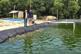
QTO - In a quiet village in central Vietnam, Le Minh Duc, 26, has turned his passion for ornamental fish into a promising startup, the first Koi breeding...

